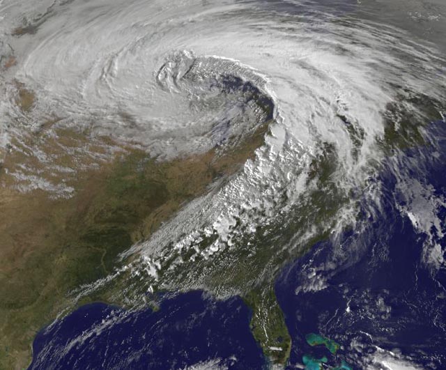
Visible satellite image of the October 26, 2010 superstorm taken at 5:32pm EDT. At the time, Bigfork, Minnesota was reporting the lowest pressure ever recorded in a U.S. non-coastal storm, 955 mb. Image credit: NASA/GSFC.
It’s being called a “super-storm”or “weather bomb.” The storm we experienced yesterday was a whopper. Although many of us escaped any damage or danger {it was actually no big deal where I was sitting}, the same cannot be said for everyone’s experience. Tornadoes, hurricane-force winds, torrential rains pummeled many areas. The lowest barometric pressure ever recorded in a non-coastal area was measured within the system’s spiral. A weather satellite image is, at once, beautiful and frightening.













 PhotonStopper