
Last Light
A storm moves in as the last spot of sunlight shines upon the bean fields of Northwestern Ohio.
Last Light
A storm moves in as the last spot of sunlight shines upon the bean fields of Northwestern Ohio.
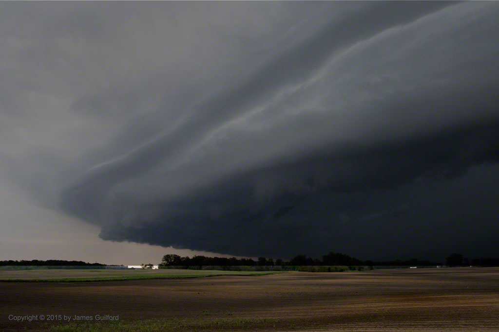
Thunderstorm Bearing Down, Sunday Evening
In the Wauseon, Ohio area this evening I sighted a large thunderstorm heading my way as I drove through farm countryside. The long stretches of road with no traffic and the openness of the fields gave me excellent opportunities to watch the storm as I tried to stay ahead of it! Alas, the storm was moving diagonally to my path and overtook me, pelting the car with wind and rain. It wasn’t me storm-chasing, the storm chased me!

Pileated Woodpecker – Male (Hylatomus pileatus)
Since wicked winter weather was expected to develop later this day, we headed out early to run a couple of important errands. Returning in the heavy snow, I spotted a big bird on my suet feeder. Wow! It was a Pileated Woodpecker (Hylatomus pileatus) the first I’d ever seen! Fortunately, I had a compact snapshot camera in my coat pocket. Rolling down the car window I made a bunch of shots and, though most were poor due to the camera’s slow action, bird’s fast motions, or blinding snowfall, I got three acceptable images. Except for forays out to clear snow from the walks, we’ll be staying in for the rest of the day but I’m certainly glad we went out this morning… if we hadn’t gone out, we wouldn’t have returned, and I’d have missed an exciting sight. Exciting, if you like birds!
Photo Details: Samsung Galaxy Camera 2: ISO 100, f/5.5, 1/10 sec., 310 mm equiv.

Hard Times. Rise Above. The scene on a gloomy day in Delphos, Ohio.

Gathering Storm 7244
Stormy weather drew me to dash to the lakefront late this afternoon. I’d missed some amazing cloud formations earlier in the day and when a second opportunity presented itself, off I went. Flying down I-71 toward Lake Erie, I could see the weather front was making faster progress than I’d have wanted; I was missing another chance at some interesting cloud structure. Still, I pressed on… Lake Erie vistas rarely disappoint. Arriving at the shore I began shooting images.
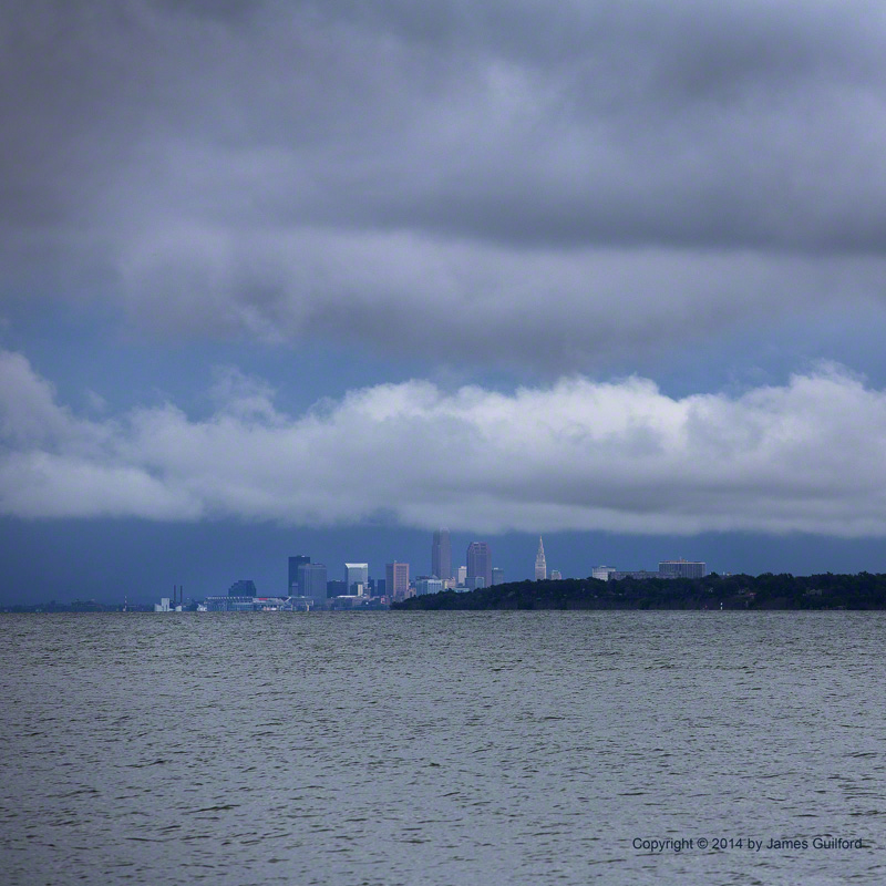
Stormy Skyline 7341
There were sights to be seen but looking toward the west, I could see rain coming in. After only a few minutes I dashed up the cliffside stairs and to my car, just in time to avoid being drenched. It appeared to me the western sky was brightening and my iPad weather radar app was showing the main part of the storm receding. I drove to another favorite location: Huntington Beach. No sunbathers there! I was free to stroll around watching dark clouds roll overhead and towards downtown Cleveland. Yes, plenty of drama! A couple of the shots are displayed here, along with another sight I saw.
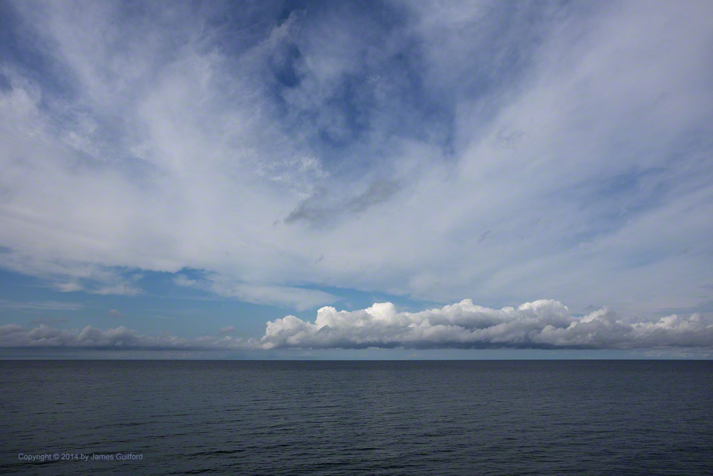
Cloud Train
As I was beginning my trip inland, I glanced across the lake: there, in a clearing sky, was a train of pretty cumulus clouds. Often, for picture taking, I like stormy weather.

A lightning-filled thunderstorm arrives overhead.
In the waning minutes of sunset, a thunderstorm was moving into the area. As the leading edge of the cloud shield floated overhead, rumbles of thunder could be heard. Looking up, I saw the sky was alive with cloud-to-cloud lightning, much of it crawling across the cloud surfaces and readily visible, illuminating the coves and knolls of the storm. Fortunately I had my camera and tripod at hand and quickly set up in the parking lot behind my car. Quickly making rough camera settings I shot frame after frame, composing as best I could from a less-than-ideal vantage point. I would have shot a lot more images — there was lightning all over the sky — but my session was cut short by rain, threatening sky-facing lenses, forcing me into the car. It was quite the show, that spring lightning!

Sunset and lightning usher in the night.
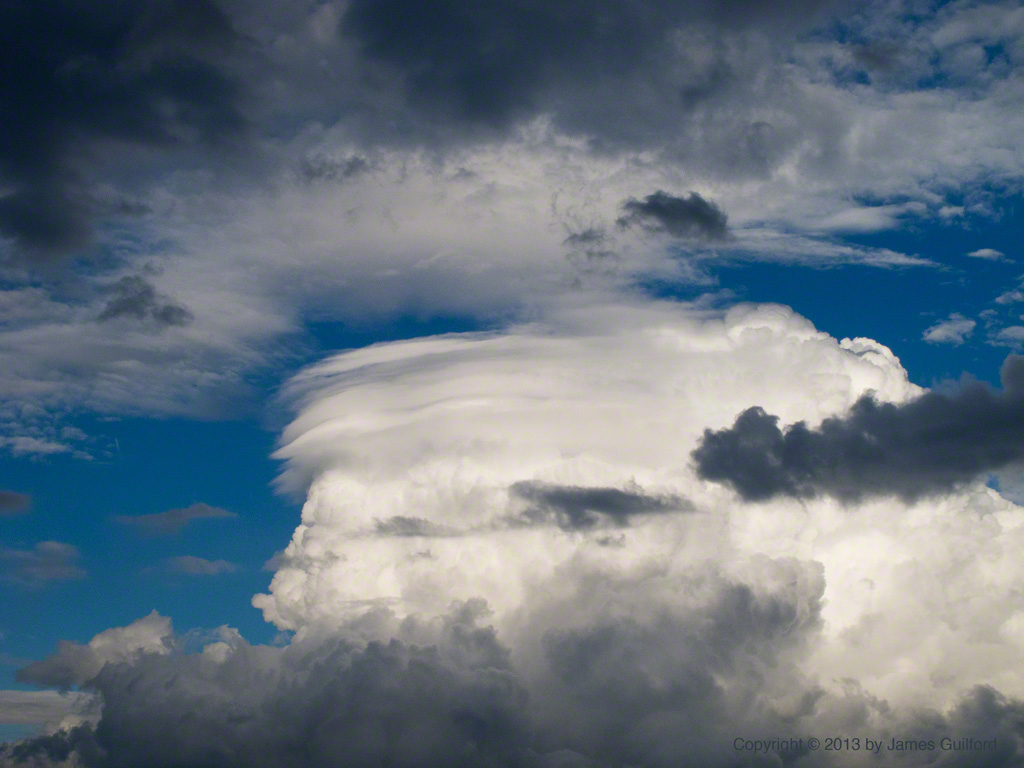
Sculpted Vapor
I’ve not been able to get out with the camera for a while and I missed my “photo Friday” entirely this week due to miserable rain. This evening, however, a break in the clouds and precipitation gave a glimpse of what was responsible: a towering cloud was building above scudding dark remnants, set against a sharp blue sky. I found an open spot and, with my little PowerShot G11, captured what I could of the scene. In the space of about 10 minutes, the boiling dome of cloud billowed upwards. As it exploded upward, the white cloud was sculpted by high winds cutting grooves in the tower and rolling filaments into streamers off to the north. It wasn’t long before the building storm cloud was hidden by much lower, less interesting layers. It was a fine few minutes spent watching nature sculpt water vapor.

Hailstone from Thunderstorm, June 25, 2013
The weather outside is frightful! Hot and humid days, lately, have been punctuated by strong thunderstorms. Tonight’s blew in with rushing winds, hail, rain, hail, lightning, rain, hail… you get the idea. We’re to expect more storms over the next few hours as well. What most impressed me with this evening’s first storm was the hail, the likes of which I’ve not seen in a long time, if ever. I ventured out to collect one of the stones from our patio and popped it into the freezer. A little later I shot the photo shown here with a ruler; that stone was not the exception tonight! We can use the rain but, goodness, such stormy weather!

The Storm Arrives – iPod Photo
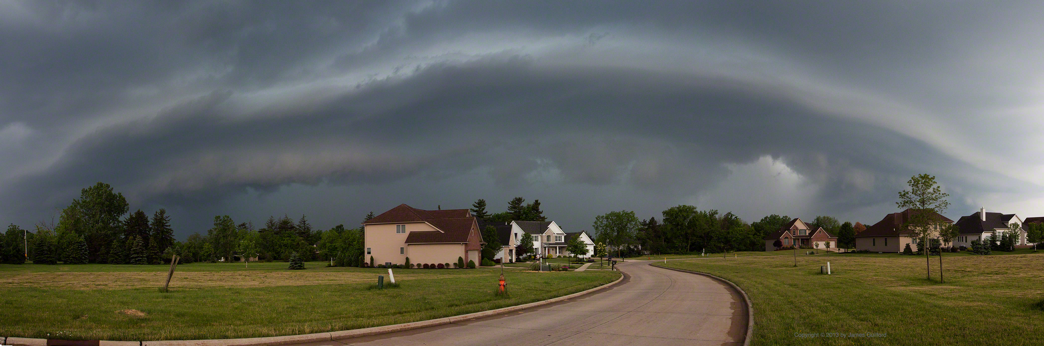
There’s a Change in the Weather.
I was heading towards home this evening when I noticed the skies darkening in the southwest. Some relatively compact but intense thunderstorms had been driving through the area and it looked like this one was headed my way. In fact, as I turned south I could see the dramatic leading edge of the storm rolling towards me. I pulled off into the first open area I could find, whipped out my camera and started shooting. I did one series of shots with the intent of creating a panorama of the amazing scene. Then some rain drops started falling. I got back into my car and had traveled no more than about a quarter-mile when the deluge began! The area was pummeled by extremely intense rain driven by strong winds. Within half an hour the rain had stopped. An interesting way to end the week.

Wind-Driven Rain Pummels the Area

Clouds Building over Lake Erie
This was the scene midday over Lake Erie off Bay Village, Ohio: clouds building over the water and a tiny boat heading in to dock. A few hours later the sky became overcast and a compact thunderstorm drenched the area. It looks like it will be a stormy and wet weekend. We shall see what the next couple of days bring but we hope to get out and enjoy.
